
Our first trip of the season! We’re finally off from the docks in Ushuaia and the day could not have been better. Sun shining as we sailed down the Beagle in short sleeves!! That doesn’t happen too often. A glorious day to start the season!


To get to Isla de los Estados we must sail east through the Beagle Channel, Past Puerto Williams on the Chilean side, past Harberton, the first Estancia in Tierra del Fuego, past Punta Moat, the end of the dirt road and the final Argentine Coast Guard station along the channel. past the collection of eastern Chilean Island – Lennox, Picton, Nueva. Once we left the islands, Liz was on watch and she spotted what we was either a humpback or fin whale! our first to see in this area! At last anchorage for the night – Puerto Espanol. A large bay facing east that has a long beach all the way inside. We dropped anchor and went to bed.
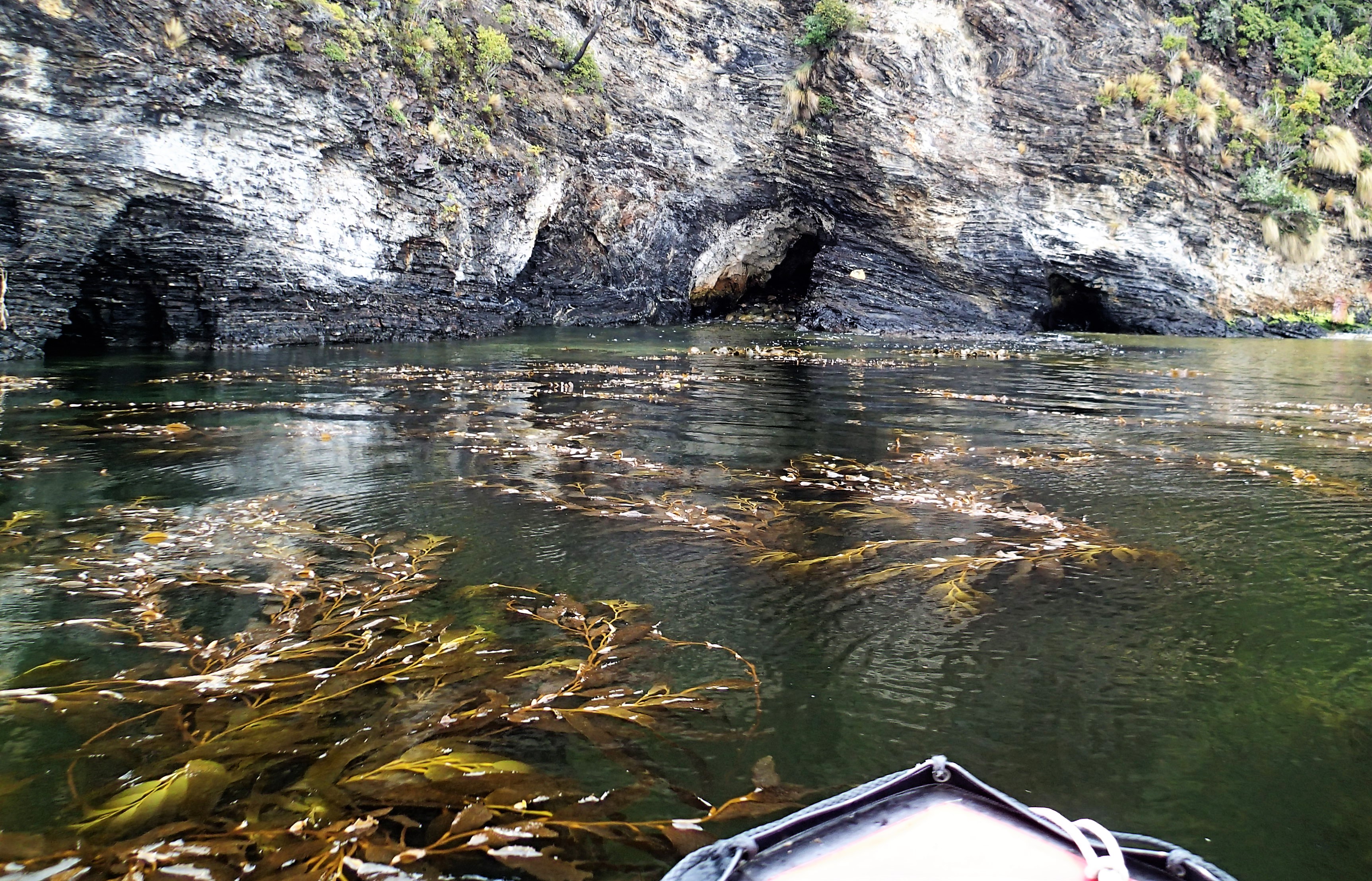
In the morning we explored the bay and the amazing historical sites. Puerto Espanol was the site where the first missionaries to the region retreated to – Allen Gardiner and his men after having a rough time with the Yaghans. They were low on provisions, had no ammunition, and decided a cave was the best place to wait for help. 4 died in the cave and 2 died in one of their boats along the shore they used for shelter after waiting 6 months for rescue.

Perhaps we need to read more into their story, but the area had extensive wood, they had a carpenter, there is extensive sea and land resources for food. So we were a bit stumped as to their demise, especially since all of us have been reading a much about Shackleton recently. We do know they seemed to have put so much faith that they were doing God’s will that they succumbed to their fate – but further reading is now required after visiting the site!
We also explored the long beach which was the site of an old estancia and now a well cared for Refugio. We also discovered one of the corners of a “cube in the earth”. Some architectural group from Spain had as some design project to figure out the configuration of placing an imaginary cube in the earth so that all corners would hit land. Turns out there are very few configurations. After they figured out one that worked, they went and put pyramids at each of the corers, to appear as if the corners of the cube were sticking out. and low and behold – one of the corners is in Puerto Espanol. We went and found it – sitting up on a rock out-cropping on the beach. Its also now a testament to the shifting sands, as a report from February said it was covered by sand, except the top 10cm. When we found it, it was completely uncovered and the rocks were uncovered, so that the top point was at leas 6-8 feet above the sand! Amazing what a few months and the wind can do.


That night we hunkered down to watch the documentary from Gaucho’s del Mar – Peninsula Mitre, which follows them as they try to surf the very area we were anchored. It was interesting to see the area from a different perspective!
and tomorrow we continue the journey to Isla de los Estados!
One reply on “History, Caves and Cubes on the way to Isla de los Estados”
Fascinating places and stories! Thanks for posting!